- Home
- Administration
- Aeronautics
- Business with WYDOT
- Construction Projects
- Driver License and Records
- Economic Stimulus Projects (ARRA - TIGER)
- Engineering and Technical Programs
- Fuel Tax
- Highway Safety
- Human Resources
- Manuals and Publications
- News and Information
- Permits
- Planning/Projects/Research
- Titles, Plates and Registration
- Travel
- Trucking / Commercial Vehicles
- Vehicle Business Regulation
- Wyoming Highway Patrol
- Search
- Sitemap
Traffic Data
The following information is provided as a reference by the Wyoming Department of Transportation. Traffic volumes included are estimates.
Traffic Volume and Vehicle Miles Book
Annual Average Daily Traffic estimates (AADTs) are derived from three primary sources of data: permanent traffic recorders, portable traffic recorders and Manual traffic classification counts. AADTs are multiplied by road length to calculate Vehicle Miles Traveled.
2024 Vehicle Miles Book - Excel format (data for 1970-2024)
2024 Vehicle Miles Book - PDF Format (data for 2022, 2023 and 2024 only)
Interactive Transportation System Map
The Interactive Transportation System Map provides traffic count data and other information about the state road system. The map uses GIS technology to allow users to choose from one or more data layers, the last being Traffic Counts. Note: the map currently uses 2021 traffic count data
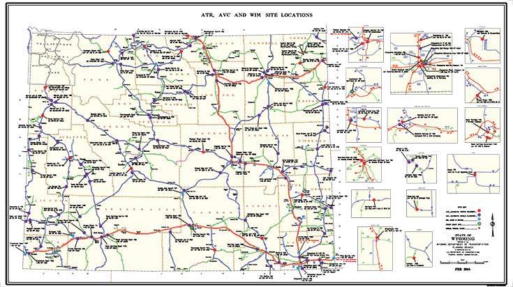
Annual Automatic Traffic Recorder Report Map
Monthly Automatic Traffic Recorder Reports
A summary of data collected by month at various traffic monitoring sites in Wyoming.
Past years reports can be found under the "navigate" menu on the top right side of this page.
January, 2025 MONTHLY VOLUME REPORT.pdf
(785.64 KB)
FEBRUARY 2025 MONTHLY VOLUME REPORT.pdf
(785.36 KB)
MARCH 2025 MONTHLY VOLUME.pdf
(815.93 KB)
APRIL 2025 MONTHLY VOLUME.pdf
(815.35 KB)
MAY 2025 MONTHLY VOLUME.pdf
(814.07 KB)
JUNE 2025 MONTHLY VOLUME.pdf
(808.48 KB)
JULY 2025 MONTHY VOLUME.pdf
(784.69 KB)
AUGUST 2025 MONTHLY VOLUME.pdf
(785.04 KB)
SEPTEMBER 2025 MONTHLY VOLUME.pdf
(784.8 KB)
October 2025 Monthly Volume Report.pdf
(784.96 KB)
NOVEMBER 2025 MONTHLY VOLUME.pdf
(820.03 KB)
DECEMBER 2025 MONTHLY VOLUME
(782.9 KB)
Monthly Hourly, Day of the Week Summary
These documents show average daily traffic counts for the day of the week and time of day.
Past years reports can be found under the "navigate" menu on the top right side of this page.
JANUARY 2025 MONTHLY HOURLY VOLUME REPORT.pdf
(14 MB)
FEBRUARY 2025 MONTHLY HOURLY VOLUME.pdf
(13.05 MB)
MARCH 2025 MONTHLY HOURLY VOLUME.pdf
(15.36 MB)
APRIL 2025 MONTHLY HOURLY VOLUME.pdf
(15.14 MB)
MAY 2025 MONTHLY HOURLY VOLUME.pdf
(14.38 MB)
JUNE 2025 MONTHLY HOURLY VOLUME.pdf
(14.23 MB)
JULY 2025 MONTHLY HOURLY VOLUME.pdf
(14.19 MB)
AUGUST 2025 MONTHLY HOURLY VOLUME.pdf
(15.06 MB)
SEPTEMBER 2025 MONTHLY HOURLY VOLUME.pdf
(12.87 MB)
OCT 2025 MONTHLY HOURLY VOLUME.pdf
(14.12 MB)
NOVEMBER 2025 MONTHLY HOURLY VOLUME.pdf
(12.73 MB)
DECEMBER 2025 MONTHLY HOURLY VOLUME
(11.79 MB)


