- Home
- Administration
- Aeronautics
- Business with WYDOT
- Construction Projects
- Driver License and Records
- Economic Stimulus Projects (ARRA - TIGER)
- Engineering and Technical Programs
- Fuel Tax
- Highway Safety
- Human Resources
- Manuals and Publications
- News and Information
- Permits
- Planning/Projects/Research
- Titles, Plates and Registration
- Travel
- Trucking / Commercial Vehicles
- Vehicle Business Regulation
- Wyoming Highway Patrol
- Search
- Sitemap

Wetlands
Wetlands
Contact information:
Deb Ferguson
WYDOT Wetland Analyst
(307) 777-4702
What are wetlands and where are they located?
The term wetlands refers specifically to areas inundated or saturated by surface or groundwater at a frequency and duration sufficient to support, and that under normal circumstances do support, a prevalence of vegetation typically adapted for life in saturated soil conditions [40 CFR 230.3(t)]. Wetlands must meet three basic criteria: 1) a predominance of hydrophytic ("water-loving") vegetation, 2) hydric (anaerobic) soils, and 3) hydrology (periodically flooded and/or saturated soils).
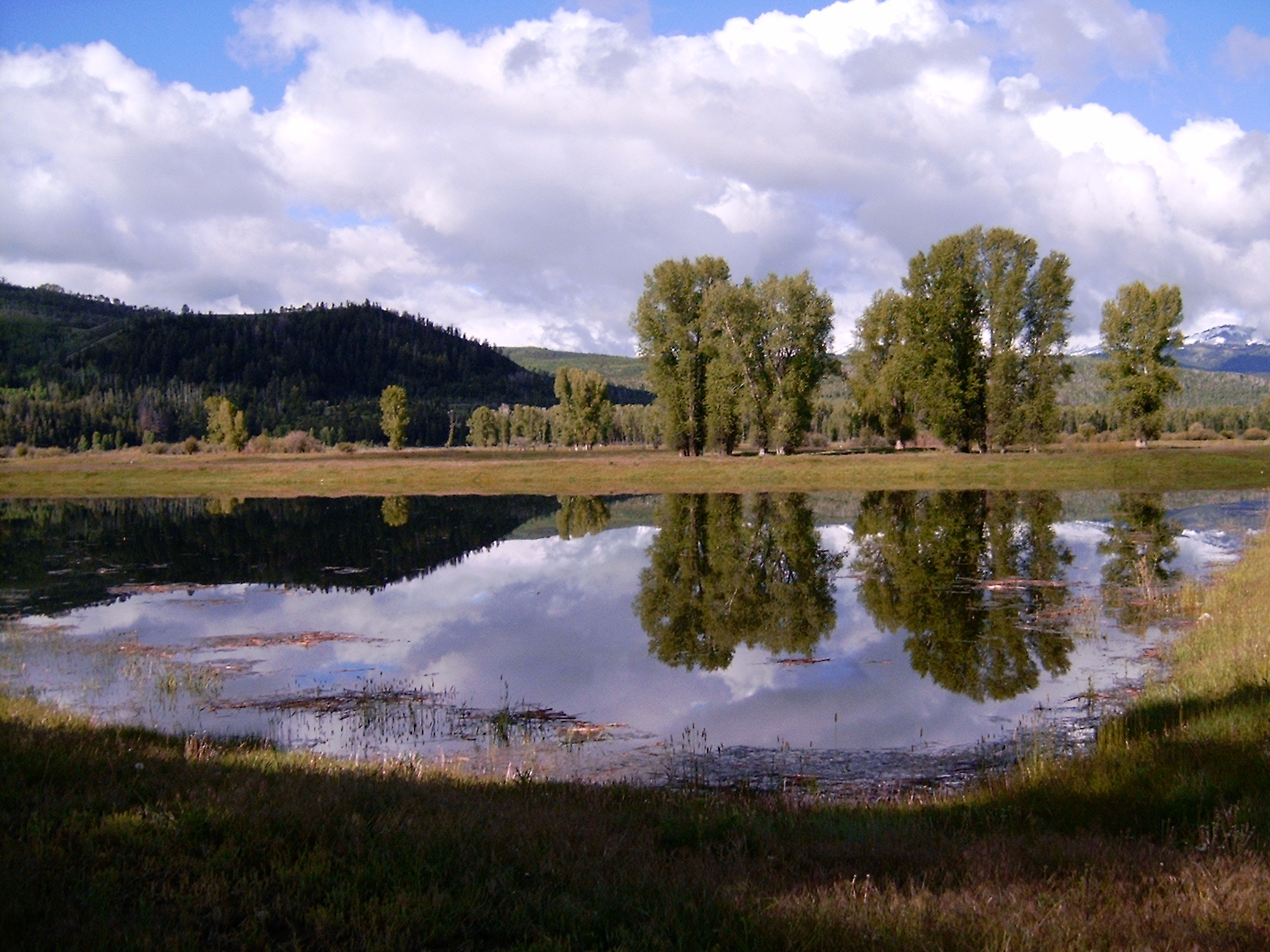
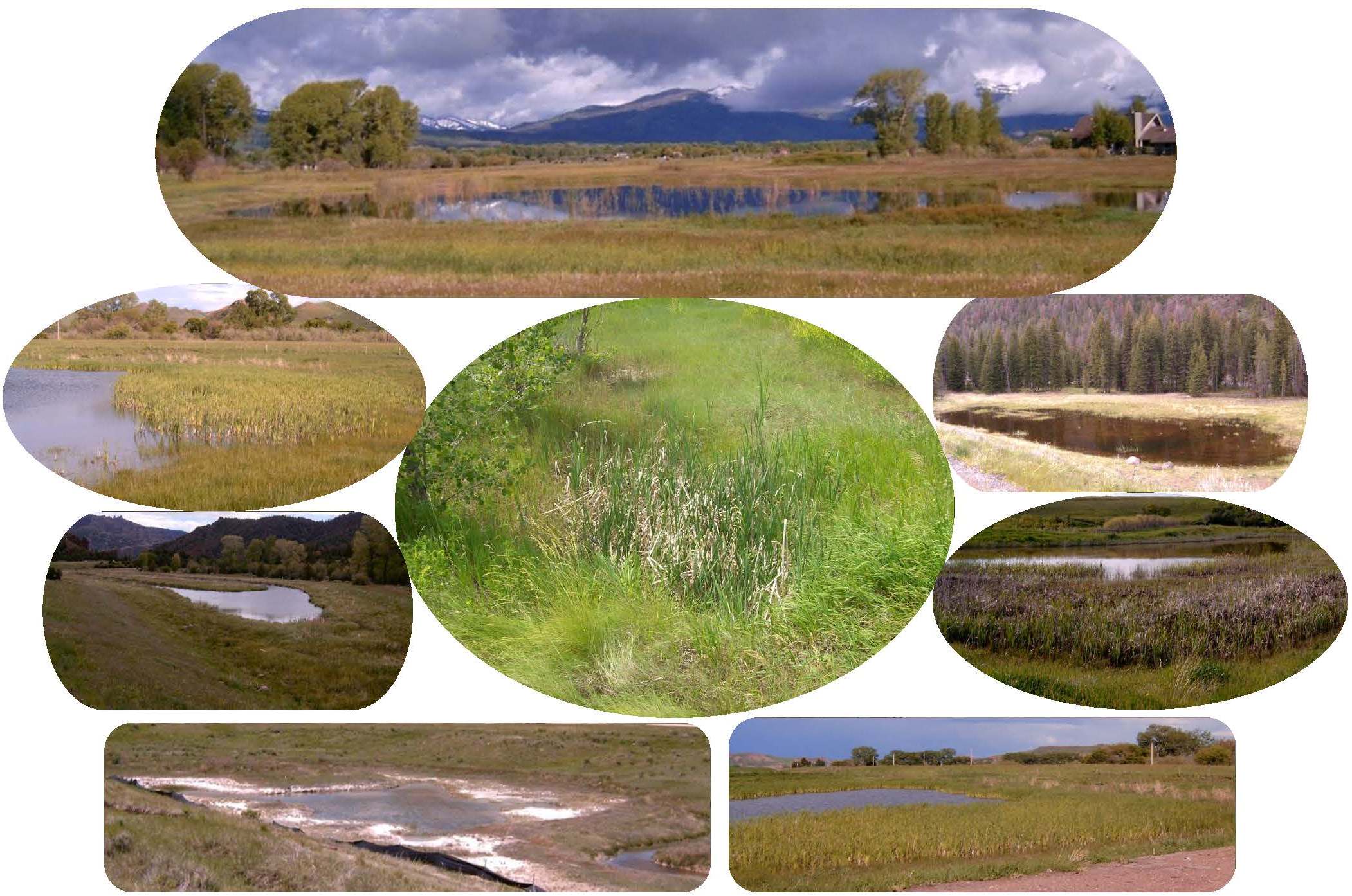
Many varieties of wetlands occur in Wyoming, including seasonally flooded basins, freshwater marshes, saline marshes, wet meadows, riverine-fringe wetlands, playas, forested wetlands, shrub swamps and very rarely, bogs and fens. Less than 3 percent of the surface area of Wyoming currently qualifies as "wetland"1.
Since wetlands are considered a valuable public resource, they are protected under Section 404 of the Clean Water Act. They provide many benefits such as flood water retention, sediment entrapment, groundwater recharge, recreation (i.e. hunting) and valuable wildlife habitat.
Why does WYDOT protect wetlands?
Clean Water Act 404 regulations require outright avoidance of wetlands, if possible. When wetlands cannot be avoided, regulations then require impacts to be minimized to the greatest extent practicable. Any remaining wetland impacts must then be mitigated via creation, restoration or rarely, by enhancement. Currently WYDOT mitigates wetlands "in-kind" on a project-by-project basis, however statewide wetland banking will be pursued in the near future.
When a WYDOT project is likely to impact surface waters, Environmental Services will have the project corridor delineated to determine the locations and boundaries of wetlands within the confines of the project. Once actual wetland impacts have been determined and a mitigation plan developed, Environmental Services will then obtain the necessary 404 permit from the Cheyenne Office of the U.S. Army Corps of Engineers so the project can go forward.
1 http://www.aswm.org/, accessed 12-22-10
2 Environmental Laboratory. (1987). "Corps of Engineers Wetlands Delineation Manual," Technical Report Y- 87-1, U.S. Army Engineer Waterways Experiment Station, Vicksburg, MS.